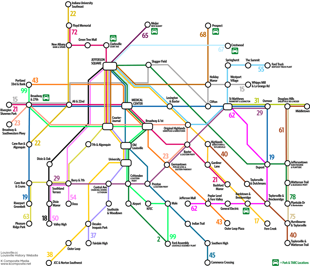
Louisville’s TARC bus system is a complex network with dozens of routes and thousands of stops.
This map simplifies the system like a subway map. By removing exact route detail and only presenting popular destinations, the necessary routes one must take become much clearer.
Places which appear as “stations” on this map may actually be areas which require a few blocks of walking to make connections.
Note that this map was last updated in 2009. TARC dramatically changed its routes and service offerings in 2026. So even though the routes on the map are outdated, we’re keeping it archived. The map and this website are not affiliated with TARC.
For exact locations of bus stops, routes and schedules, visit www.ridetarc.org.